")
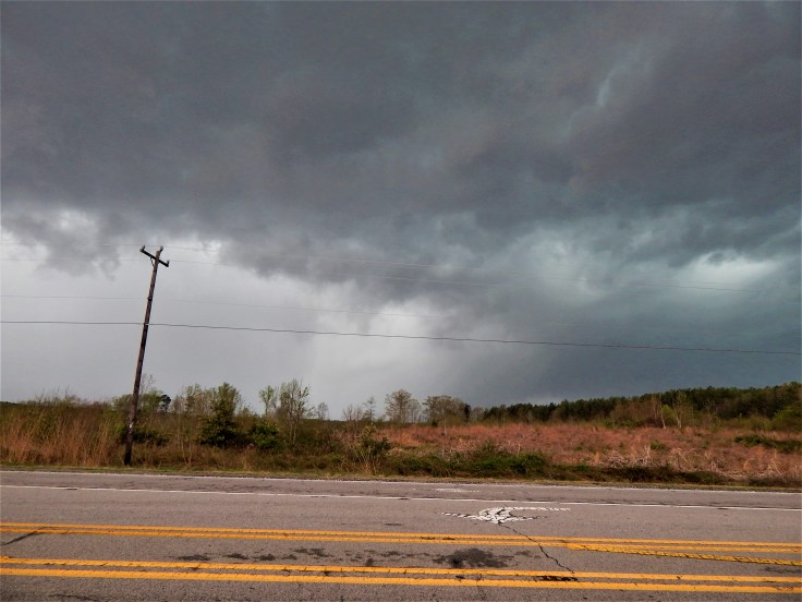
While sitting in Danville, we noticed a tornado warning on a cell/part of the line crossing Greensboro, NC, but we decided to wait for the storm to come to us. And then it showed up on radar. Unfortunately, in my excitement, I failed to get a screenshot of the radar, but upon seeing a definitive debris signature in the correlation coefficient we jumped back into the Storm Trooper (and almost left someone in the Sheetz restroom) to dive south on Hwy 29 to intercept. We made it to the town of Riffin, NC before pulling off to observe this view

After watching for a few minutes, we decided to pack up and move back north, a decision we would later be extremely happy about (but we’ll explain why later). After retreating up 1 exit on Hwy 29, we stopped again on the northeast side of Ruffin and desperately searched the rain bands for any hint of the funnel (not knowing for sure if anything was still on the ground), but as you can see, there wasn’t much to look at:

With CG lightning ( and not to mention a possible tornado) bearing down, we decided to put a bit more distance between us and the storm, so we fell back to the welcome center just south of the state line briefly before deciding it was best to get back to Rt 58 and get east with the ultimate goal of heading north on Rt 360 to catch back up. We had done well to this point to keep out of the heaviest of the precip, but traffic lights had other plans. Just after getting a green light, we were smacked by high winds and immediate heavy rain. ( We would later find out that this was actually tornadic inflow as the storm re-spawned a tornado on the west side of Danville) Powering on to get out of the now-bowing line, we were repeatedly slammed by small rotations that spun up on the edge of the line. We weren’t able to get an accurate measurement of the winds, but we happened to be in just the right place at the right time to see the roof lift off of this lumber facility

so it’s likely that the wind was in the 70-80mph range at times. We did eventually clear the line and retreat to South Boston, but sadly that was effectively the end of the day.
Video from inside the line: https://www.youtube.com/watch?v=XgTzcE6tCaw
The mesocyclone went on to produce an EF-3 tornado on the West/Northwest sides of Lynchburg, but we were unable to pursue. I bet you’re probably wondering why a ended up being very glad that we didn’t loiter around Ruffin too long. Well, NWS surveys determined that there was indeed an EF-2 tornado on the ground through Rockingham County. How close did it come to our positions? We’ll le the map do the talking:

Yep, that red line is the tornado track. It passed within 1000 yards of our first vantage point and just a few hundred feet of our second stop. Since the tornado was rain-wrapped, we wouldn’t have known we were in trouble until it was far too late. That being said, our whole crew owes a huge thanks to our driver and navigator, Peter and Mark, for making the right calls to keep us safe.
Overall, it was a very successful chase despite the fact that we couldn’t see the tornado that we had such a close encounter with. But chase success isn’t determined solely by seeing a tornado. We’re out there primarily as spotters to help the NWS get ground truth to go with radar data and to assist those who may be affected by storms, as some other chasers that we know did in the Greensboro area; giving up their chase to help the community. Only after making sure our job is done do we get to have fun (like punching tornadic inflow).

Leave a comment