 Trip Around VA and NC")
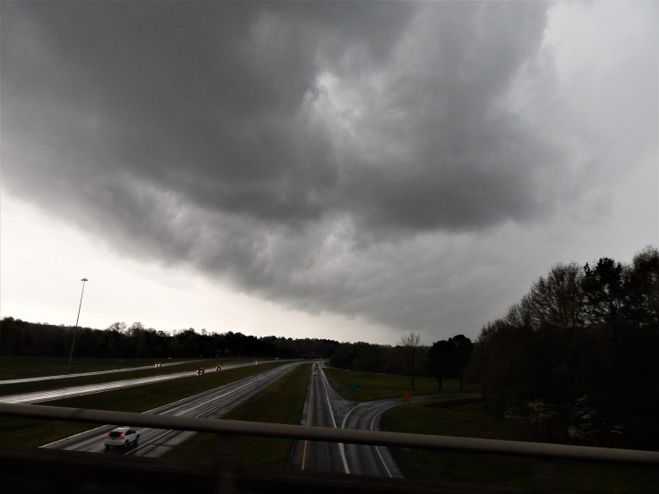
About a week ago, the GFS began hinting at a severe setup for the west/central VA and NC area for Sunday, 4/15/18, and sure enough, Sunday morning found a crew of chasers rolling our of Blacksburg around 9:15 AM. With an ongoing convective line from Saturday churning its way NNE through the mountains, we headed for Statesville, NC to grab some lunch and wait for discrete cells to fire ahead of the line. After a quick bite to eat, we were greeted not by the cells we were hoping for, but by this shelf and some thunder as the line rumbled past to our west.
As the eastward component brought the line closer, a couple of cells initiated immediately ahead of it, so we loaded up to follow them up I-77 and entered the whale’s mouth as we entered the highway.
After a few minutes of playing catch-up, we noticed a beautiful green in the cell immediately in front of us (which I sadly could not photograph due to being in the back seat) which Carroll County would later find out was caused by tennis-ball size hail, as well as a strengthening mesocyclone. After realizing that this storm was about to run into the high terrain around Fancy Gap, we bailed off the interstate near Mt. Airy in order to get east to set up for our next round but we paused to watch our first cell’s meso get into a fight with a mountain:

From here, it was an easy trot into Danville, where we planned to sit until something interesting happened. Shortly before our arrival, a portion of the line near Greensboro, NC acquired a tornado warning but we continued on our path. Just after pulling into a gas station, we heard from a friend who was near Greensboro that there had almost certainly been a touchdown, so we cut our break short and moved to intercept; a story that deserves its own post.

Leave a comment